
Thank you for supporting this site ❤️
Make a donation
Make a donation
Mount Shavano topographic map
Click on the map to display elevation.
Thank you for supporting this site ❤️
Make a donation
Make a donation
About this map
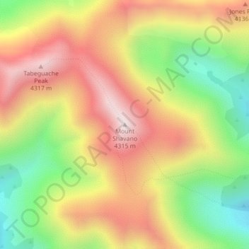
Name: Mount Shavano topographic map, elevation, terrain.
Location: Mount Shavano, Chaffee County, Colorado, United States (38.61905 -106.23929 38.61915 -106.23919)
Average elevation: 3,947 m
Minimum elevation: 3,532 m
Maximum elevation: 4,333 m
Thank you for supporting this site ❤️
Make a donation
Make a donation
Other topographic maps
Click on a map to view its topography, its elevation and its terrain.