
Firgas topographic map
Interactive map
Click on the map to display elevation.
About this map
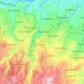
Name: Firgas topographic map, elevation, terrain.
Location: Firgas, Las Palmas, Canary Islands, Spain (28.07521 -15.57735 28.14307 -15.53913)
Average elevation: 411 m
Minimum elevation: 18 m
Maximum elevation: 953 m