
Thank you for supporting this site ❤️
Make a donation
Make a donation
Wahnsdorf topographic map
Click on the map to display elevation.
Thank you for supporting this site ❤️
Make a donation
Make a donation
About this map
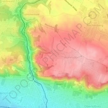
Name: Wahnsdorf topographic map, elevation, terrain.
Location: Wahnsdorf, Radebeul, Meißen, Sachsen, Deutschland (51.11095 13.65326 51.12837 13.69310)
Average elevation: 190 m
Minimum elevation: 113 m
Maximum elevation: 249 m
Thank you for supporting this site ❤️
Make a donation
Make a donation