
Thank you for supporting this site ❤️
Make a donation
Make a donation
Valverde topographic map
Click on the map to display elevation.
Thank you for supporting this site ❤️
Make a donation
Make a donation
About this map
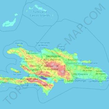
Name: Valverde topographic map, elevation, terrain.
Location: Valverde, Dominican Republic (16.98205 -73.64611 22.18205 -68.44611)
Average elevation: 86 m
Minimum elevation: -44 m
Maximum elevation: 2,929 m
Thank you for supporting this site ❤️
Make a donation
Make a donation
Other topographic maps
Click on a map to view its topography, its elevation and its terrain.