
Thank you for supporting this site ❤️
Make a donation
Make a donation
Jarvis topographic map
Click on the map to display elevation.
Thank you for supporting this site ❤️
Make a donation
Make a donation
About this map
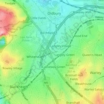
Name: Jarvis topographic map, elevation, terrain.
Average elevation: 179 m
Minimum elevation: 134 m
Maximum elevation: 270 m
Thank you for supporting this site ❤️
Make a donation
Make a donation
Other topographic maps
Click on a map to view its topography, its elevation and its terrain.
Causeway Green Park
United Kingdom > England > Sandwell > Causeway Green > The Ashes
Average elevation: 184 m