
Thank you for supporting this site ❤️
Make a donation
Make a donation
Dauphin Island topographic map
Click on the map to display elevation.
Thank you for supporting this site ❤️
Make a donation
Make a donation
About this map
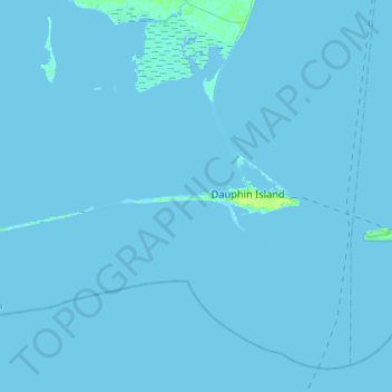
Name: Dauphin Island topographic map, elevation, terrain.
Location: Dauphin Island, Mobile County, Alabama, 36528, United States (30.21454 -88.35146 30.29079 -88.06422)
Average elevation: 0 m
Minimum elevation: -1 m
Maximum elevation: 12 m
Thank you for supporting this site ❤️
Make a donation
Make a donation
Other topographic maps
Click on a map to view its topography, its elevation and its terrain.
Thank you for supporting this site ❤️
Make a donation
Make a donation
Thank you for supporting this site ❤️
Make a donation
Make a donation
Thank you for supporting this site ❤️
Make a donation
Make a donation
Thank you for supporting this site ❤️
Make a donation
Make a donation