
Thank you for supporting this site ❤️
Make a donation
Make a donation
Liblarer See topographic map
Click on the map to display elevation.
Thank you for supporting this site ❤️
Make a donation
Make a donation
About this map
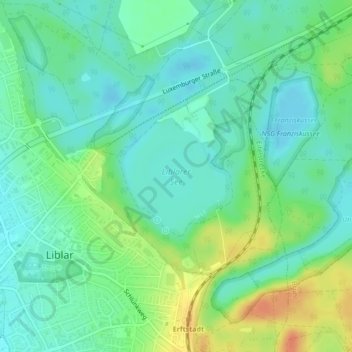
Name: Liblarer See topographic map, elevation, terrain.
Average elevation: 109 m
Minimum elevation: 95 m
Maximum elevation: 137 m
Thank you for supporting this site ❤️
Make a donation
Make a donation
Other topographic maps
Click on a map to view its topography, its elevation and its terrain.
Auf der Anrichte
Deutschland > Nordrhein-Westfalen > Rhein-Erft-Kreis > Liblar
Average elevation: 106 m