
Thank you for supporting this site ❤️
Make a donation
Make a donation
Hohe Warte topographic map
Click on the map to display elevation.
Thank you for supporting this site ❤️
Make a donation
Make a donation
About this map
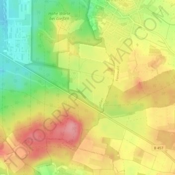
Name: Hohe Warte topographic map, elevation, terrain.
Location: Hohe Warte, Gießen, Landkreis Gießen, Hessen, 35394, Deutschland (50.55585 8.73477 50.57585 8.75477)
Average elevation: 244 m
Minimum elevation: 187 m
Maximum elevation: 292 m
Thank you for supporting this site ❤️
Make a donation
Make a donation
Other topographic maps
Click on a map to view its topography, its elevation and its terrain.