
Thank you for supporting this site ❤️
Make a donation
Make a donation
Baileyville topographic map
Click on the map to display elevation.
Thank you for supporting this site ❤️
Make a donation
Make a donation
About this map
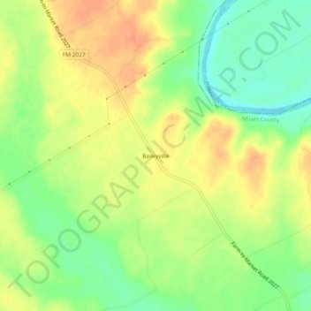
Name: Baileyville topographic map, elevation, terrain.
Location: Baileyville, Milam County, Texas, United States (31.03268 -96.84859 31.07268 -96.80859)
Average elevation: 107 m
Minimum elevation: 85 m
Maximum elevation: 125 m
Thank you for supporting this site ❤️
Make a donation
Make a donation
Other topographic maps
Click on a map to view its topography, its elevation and its terrain.