
Thank you for supporting this site ❤️
Make a donation
Make a donation
Houthulst topographic map
Click on the map to display elevation.
Thank you for supporting this site ❤️
Make a donation
Make a donation
Houthulst
Houthulst ligt in Zandlemig Vlaanderen, op een uitloper van de Midden-West-Vlaamse Heuvelrug op een hoogte van ongeveer 20 meter. Het hoogste punt is 30 meter, in het noordwesten van de kom. Bekend zijn de Zanddambeek en de Corverbeek.
Thank you for supporting this site ❤️
Make a donation
Make a donation
About this map
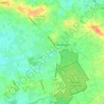
Name: Houthulst topographic map, elevation, terrain.
Location: Houthulst, Diksmuide, West-Vlaanderen, België (50.94853 2.92193 50.99925 2.97371)
Average elevation: 19 m
Minimum elevation: 4 m
Maximum elevation: 46 m
Thank you for supporting this site ❤️
Make a donation
Make a donation
Other topographic maps
Click on a map to view its topography, its elevation and its terrain.