Geolocate
👉 Easily get elevation data in JSON, GeoTIFF and KML formats using Elevation API
Thank you for supporting this site ❤️
Make a donation

Shashu topographic map

Click on the map to display elevation.

👉 Easily get elevation data in JSON, GeoTIFF and KML formats using Elevation API
Thank you for supporting this site ❤️
Make a donation

About this map

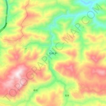
Name: Shashu topographic map, elevation, terrain.

Location: Shashu, Zhaotong City, Yunnan, China (27.64249 104.39836 27.72249 104.47836)

Average elevation: 1,429 m

Minimum elevation: 918 m

Maximum elevation: 1,974 m

Other topographic maps

Click on a map to view its topography, its elevation and its terrain.

Yanjin County

China > Yunnan > Zhaotong City

Average elevation: 1,163 m

Yanjin County

China > Yunnan > Zhaotong City

Average elevation: 1,163 m