
Thank you for supporting this site ❤️
Make a donation
Make a donation
Raleigh County topographic map
Click on the map to display elevation.
Thank you for supporting this site ❤️
Make a donation
Make a donation
About this map
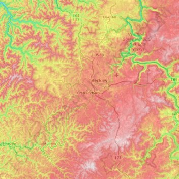
Name: Raleigh County topographic map, elevation, terrain.
Location: Raleigh County, West Virginia, United States (37.50783 -81.57163 37.99019 -80.87676)
Average elevation: 679 m
Minimum elevation: 239 m
Maximum elevation: 1,081 m
Thank you for supporting this site ❤️
Make a donation
Make a donation
Other topographic maps
Click on a map to view its topography, its elevation and its terrain.