
Clondalkin, Lucan and Palmerston Parish topographic map
Interactive map
Click on the map to display elevation.
About this map
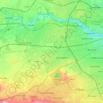
Name: Clondalkin, Lucan and Palmerston Parish topographic map, elevation, terrain.
Average elevation: 70 m
Minimum elevation: 5 m
Maximum elevation: 183 m
Other topographic maps
Click on a map to view its topography, its elevation and its terrain.
Clondalkin
Ireland > County Dublin > Clondalkin
Clondalkin, South Dublin, County Dublin, Leinster, Ireland
Average elevation: 73 m