
Thank you for supporting this site ❤️
Make a donation
Make a donation
Thompson Springs topographic map
Click on the map to display elevation.
Thank you for supporting this site ❤️
Make a donation
Make a donation
About this map
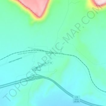
Name: Thompson Springs topographic map, elevation, terrain.
Location: Thompson Springs, Grand County, Utah, 84540, United States (38.95108 -109.73374 38.99108 -109.69374)
Average elevation: 1,583 m
Minimum elevation: 1,513 m
Maximum elevation: 1,872 m
Thank you for supporting this site ❤️
Make a donation
Make a donation
Other topographic maps
Click on a map to view its topography, its elevation and its terrain.