
Thank you for supporting this site ❤️
Make a donation
Make a donation
Damascus topographic map
Click on the map to display elevation.
Thank you for supporting this site ❤️
Make a donation
Make a donation
About this map
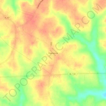
Name: Damascus topographic map, elevation, terrain.
Location: Damascus, Coffee County, Alabama, United States (31.30045 -86.02439 31.34045 -85.98439)
Average elevation: 102 m
Minimum elevation: 68 m
Maximum elevation: 121 m
Thank you for supporting this site ❤️
Make a donation
Make a donation
Other topographic maps
Click on a map to view its topography, its elevation and its terrain.