
Cherry Hill topographic map
Interactive map
Click on the map to display elevation.
About this map
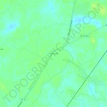
Name: Cherry Hill topographic map, elevation, terrain.
Average elevation: 9 m
Minimum elevation: 2 m
Maximum elevation: 15 m
Other topographic maps
Click on a map to view its topography, its elevation and its terrain.
Litchfield Beach
United States > South Carolina > Georgetown County
Litchfield Beach, Georgetown County, South Carolina, 29585, United States
Average elevation: 2 m
Marysville
United States > South Carolina > Georgetown County
Marysville, Georgetown County, South Carolina, 29585, United States
Average elevation: 4 m
Litchfield by the Sea
United States > South Carolina > Georgetown County > North Litchfield Beach
Litchfield by the Sea, North Litchfield Beach, Georgetown County, South Carolina, 29585, United States
Average elevation: 2 m