
Thank you for supporting this site ❤️
Make a donation
Make a donation
Dahlem topographic map
Click on the map to display elevation.
Thank you for supporting this site ❤️
Make a donation
Make a donation
About this map
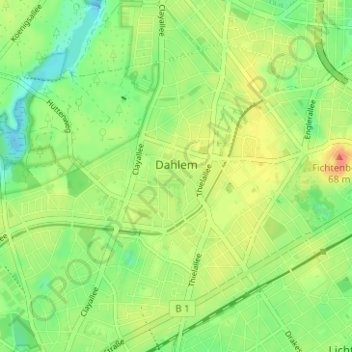
Name: Dahlem topographic map, elevation, terrain.
Location: Dahlem, Steglitz-Zehlendorf, Berlijn, 14195, Duitsland (52.44168 13.24746 52.47053 13.30999)
Average elevation: 50 m
Minimum elevation: 31 m
Maximum elevation: 72 m
Thank you for supporting this site ❤️
Make a donation
Make a donation
Other topographic maps
Click on a map to view its topography, its elevation and its terrain.