
Thank you for supporting this site ❤️
Make a donation
Make a donation
Monmouth topographic map
Click on the map to display elevation.
Thank you for supporting this site ❤️
Make a donation
Make a donation
About this map
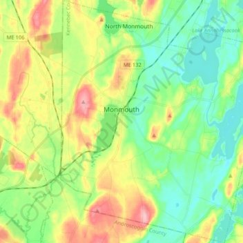
Name: Monmouth topographic map, elevation, terrain.
Location: Monmouth, Kennebec County, Maine, United States (44.17619 -70.07575 44.29016 -69.93742)
Average elevation: 88 m
Minimum elevation: 44 m
Maximum elevation: 165 m
Thank you for supporting this site ❤️
Make a donation
Make a donation
Other topographic maps
Click on a map to view its topography, its elevation and its terrain.