
Thank you for supporting this site ❤️
Make a donation
Make a donation
Rosewood topographic map
Click on the map to display elevation.
Thank you for supporting this site ❤️
Make a donation
Make a donation
About this map
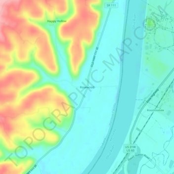
Name: Rosewood topographic map, elevation, terrain.
Location: Rosewood, Harrison County, Indiana, 40177, United States (38.01813 -85.94913 38.05813 -85.90913)
Average elevation: 160 m
Minimum elevation: 119 m
Maximum elevation: 250 m
Thank you for supporting this site ❤️
Make a donation
Make a donation
Other topographic maps
Click on a map to view its topography, its elevation and its terrain.