
柯鲁柯镇 topographic map
Interactive map
Click on the map to display elevation.
About this map
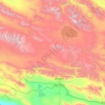
Name: 柯鲁柯镇 topographic map, elevation, terrain.
Location: 柯鲁柯镇, 德令哈市, 海西蒙古族藏族自治州, 青海省, 中国 (36.93168 96.62231 38.88682 97.56355)
Average elevation: 3,953 m
Minimum elevation: 2,681 m
Maximum elevation: 5,695 m
Other topographic maps
Click on a map to view its topography, its elevation and its terrain.