
Rebstein topographic map
Interactive map
Click on the map to display elevation.
About this map
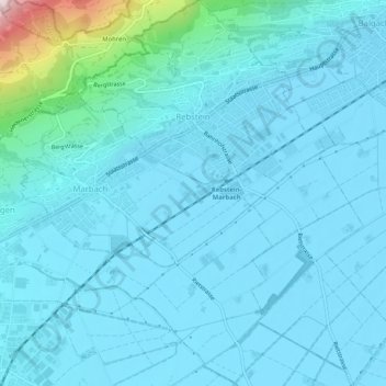
Name: Rebstein topographic map, elevation, terrain.
Location: Rebstein, Wahlkreis Rheintal, St. Gallen, 9445, Schweiz (47.37426 9.56722 47.40890 9.60875)
Average elevation: 462 m
Minimum elevation: 405 m
Maximum elevation: 1,004 m
Other topographic maps
Click on a map to view its topography, its elevation and its terrain.
Berneck
Schweiz > St. Gallen > Wahlkreis Rheintal
Berneck, Wahlkreis Rheintal, St. Gallen, 9442, Schweiz
Average elevation: 561 m