
Thank you for supporting this site ❤️
Make a donation
Make a donation
Whiteville topographic map
Click on the map to display elevation.
Thank you for supporting this site ❤️
Make a donation
Make a donation
About this map
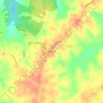
Name: Whiteville topographic map, elevation, terrain.
Location: Whiteville, Cumberland County, Virginia, United States (37.58237 -78.18750 37.62237 -78.14750)
Average elevation: 106 m
Minimum elevation: 74 m
Maximum elevation: 127 m
Thank you for supporting this site ❤️
Make a donation
Make a donation
Other topographic maps
Click on a map to view its topography, its elevation and its terrain.