
Oberhof topographic map
Click on the map to display elevation.
Oberhof
Oberhof is located in the Thuringian Forest, a low mountain range, at an altitude of about 815 meters. The town is located on a plateau, which is why there are no great differences in altitude in the built-up area. About four kilometers to the southeast are the two highest mountains in Thuringia, the 983-meter-high Großer Beerberg and the 978-meter-high Schneekopf. Southwest of Oberhof there are also two Rennsteig passes: the pass at the Grenzadler (former state border between the Duchy of Saxe-Coburg and Gotha and Prussia) and the pass at the Rondell monument. Several rivers also rise near Oberhof, the Gera in the east, the Ohra in the north, the Hasel in the south and the Schönau in the west. The surroundings of Oberhof are completely forested, the most common tree species is spruce.
About this map
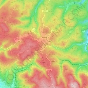
Name: Oberhof topographic map, elevation, terrain.
Average elevation: 749 m
Minimum elevation: 488 m
Maximum elevation: 976 m