
Thank you for supporting this site ❤️
Make a donation
Make a donation
Västanvik topographic map
Click on the map to display elevation.
Thank you for supporting this site ❤️
Make a donation
Make a donation
About this map
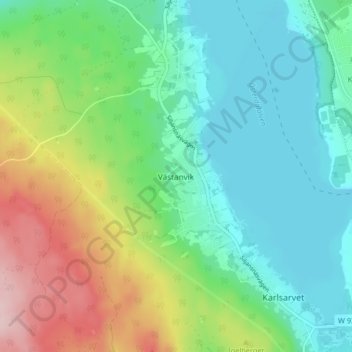
Name: Västanvik topographic map, elevation, terrain.
Location: Västanvik, Leksands kommun, Dalarna County, 793 92, Sweden (60.71145 14.92421 60.75145 14.96421)
Average elevation: 226 m
Minimum elevation: 157 m
Maximum elevation: 381 m
Thank you for supporting this site ❤️
Make a donation
Make a donation
Other topographic maps
Click on a map to view its topography, its elevation and its terrain.