
Thank you for supporting this site ❤️
Make a donation
Make a donation
Caseyville topographic map
Click on the map to display elevation.
Thank you for supporting this site ❤️
Make a donation
Make a donation
About this map
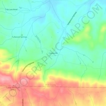
Name: Caseyville topographic map, elevation, terrain.
Location: Caseyville, Polk County, Georgia, United States (33.89316 -85.31801 33.93316 -85.27801)
Average elevation: 304 m
Minimum elevation: 253 m
Maximum elevation: 389 m
Thank you for supporting this site ❤️
Make a donation
Make a donation
Other topographic maps
Click on a map to view its topography, its elevation and its terrain.