
Thank you for supporting this site ❤️
Make a donation
Make a donation
Telgte topographic map
Click on the map to display elevation.
Thank you for supporting this site ❤️
Make a donation
Make a donation
About this map
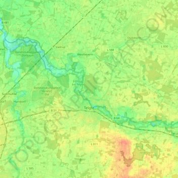
Name: Telgte topographic map, elevation, terrain.
Location: Telgte, Kreis Warendorf, North Rhine-Westphalia, 48291, Germany (51.93038 7.70382 52.06434 7.89640)
Average elevation: 55 m
Minimum elevation: 38 m
Maximum elevation: 75 m
Thank you for supporting this site ❤️
Make a donation
Make a donation
Other topographic maps
Click on a map to view its topography, its elevation and its terrain.