
Thank you for supporting this site ❤️
Make a donation
Make a donation
Weltersbach topographic map
Click on the map to display elevation.
Thank you for supporting this site ❤️
Make a donation
Make a donation
Weltersbach
Weitere Nachbarorte sind Unterbüscherhof, Ufer, Holzerhof, Schüddig, Metzholz, Schneppenpohl, Krabbenhäuschen, Scheuerhof, Friedrichshöhe, Koltershäuschen, Bremersheide, Neuwinkel, Hinterberg und Sankt Heribert. Abgegangen ist Bremersheidermühle.
Thank you for supporting this site ❤️
Make a donation
Make a donation
About this map
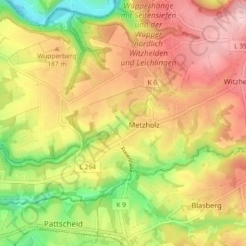
Name: Weltersbach topographic map, elevation, terrain.
Average elevation: 166 m
Minimum elevation: 66 m
Maximum elevation: 249 m
Thank you for supporting this site ❤️
Make a donation
Make a donation
Other topographic maps
Click on a map to view its topography, its elevation and its terrain.
42799
Deutschland > Nordrhein-Westfalen > Rheinisch-Bergischer Kreis > Leichlingen > Metzholz > Koltershäuschen
Average elevation: 143 m