
Thank you for supporting this site ❤️
Make a donation
Make a donation
Cheriyal topographic map
Click on the map to display elevation.
Thank you for supporting this site ❤️
Make a donation
Make a donation
About this map
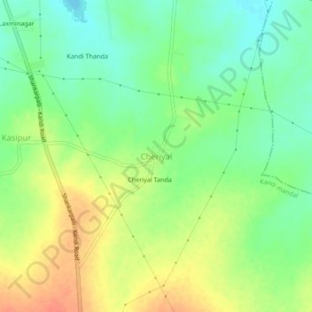
Name: Cheriyal topographic map, elevation, terrain.
Location: Cheriyal, Kandi mandal, Sangareddy, Telangana, 502329, India (17.53395 78.11141 17.57395 78.15141)
Average elevation: 547 m
Minimum elevation: 526 m
Maximum elevation: 573 m
Thank you for supporting this site ❤️
Make a donation
Make a donation