
Thank you for supporting this site ❤️
Make a donation
Make a donation
Grythyttan topographic map
Click on the map to display elevation.
Thank you for supporting this site ❤️
Make a donation
Make a donation
About this map
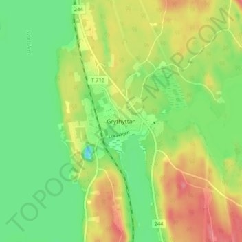
Name: Grythyttan topographic map, elevation, terrain.
Location: Grythyttan, Hällefors kommun, Provinz Örebro, 712 60, Schweden (59.68575 14.51723 59.72575 14.55723)
Average elevation: 189 m
Minimum elevation: 157 m
Maximum elevation: 229 m
Thank you for supporting this site ❤️
Make a donation
Make a donation
Other topographic maps
Click on a map to view its topography, its elevation and its terrain.