
Capel Curig topographic map
Interactive map
Click on the map to display elevation.
About this map
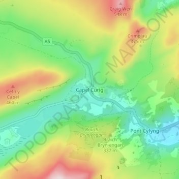
Name: Capel Curig topographic map, elevation, terrain.
Location: Capel Curig, Conwy, Wales, LL24 0EN, United Kingdom (53.08516 -3.93083 53.12516 -3.89083)
Average elevation: 298 m
Minimum elevation: 138 m
Maximum elevation: 559 m