
Thank you for supporting this site ❤️
Make a donation
Make a donation
Burghaun topographic map
Click on the map to display elevation.
Thank you for supporting this site ❤️
Make a donation
Make a donation
Burghaun
Weiterhin gibt es die Weiler Klausmarbach, Mahlertshof und Hartmannshöhe, die keinen Status als Ortsteil haben.
Thank you for supporting this site ❤️
Make a donation
Make a donation
About this map
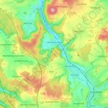
Name: Burghaun topographic map, elevation, terrain.
Location: Burghaun, Landkreis Fulda, Hessen, 36151, Deutschland (50.66747 9.60697 50.75205 9.77135)
Average elevation: 329 m
Minimum elevation: 226 m
Maximum elevation: 509 m
Thank you for supporting this site ❤️
Make a donation
Make a donation
Other topographic maps
Click on a map to view its topography, its elevation and its terrain.