
Thank you for supporting this site ❤️
Make a donation
Make a donation
Chungathara topographic map
Click on the map to display elevation.
Thank you for supporting this site ❤️
Make a donation
Make a donation
About this map
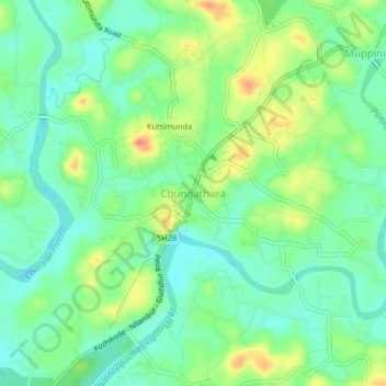
Name: Chungathara topographic map, elevation, terrain.
Location: Chungathara, Nilambur, Malappuram, Kerala, 679334, India (11.31378 76.25566 11.35378 76.29566)
Average elevation: 38 m
Minimum elevation: 18 m
Maximum elevation: 72 m
Thank you for supporting this site ❤️
Make a donation
Make a donation
Other topographic maps
Click on a map to view its topography, its elevation and its terrain.
Thank you for supporting this site ❤️
Make a donation
Make a donation