
Ovia North-East topographic map
Interactive map
Click on the map to display elevation.
About this map
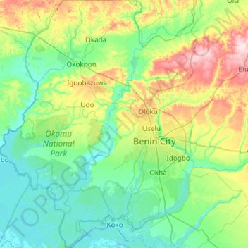
Name: Ovia North-East topographic map, elevation, terrain.
Location: Ovia North-East, Edo State, Nigeria (5.90918 5.24780 6.88598 5.86991)
Average elevation: 65 m
Minimum elevation: -3 m
Maximum elevation: 316 m
Other topographic maps
Click on a map to view its topography, its elevation and its terrain.