
Thank you for supporting this site ❤️
Make a donation
Make a donation
Thap Put topographic map
Click on the map to display elevation.
Thank you for supporting this site ❤️
Make a donation
Make a donation
About this map
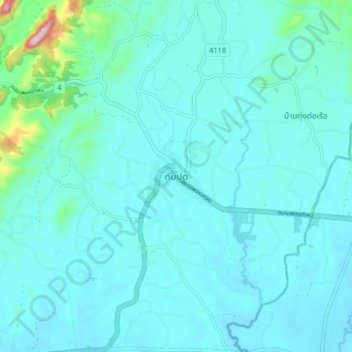
Name: Thap Put topographic map, elevation, terrain.
Location: Thap Put, Phang-nga Province, Thailand (8.47676 98.59738 8.55676 98.67738)
Average elevation: 43 m
Minimum elevation: 3 m
Maximum elevation: 377 m
Thank you for supporting this site ❤️
Make a donation
Make a donation