
Thank you for supporting this site ❤️
Make a donation
Make a donation
Steinheim topographic map
Click on the map to display elevation.
Thank you for supporting this site ❤️
Make a donation
Make a donation
About this map
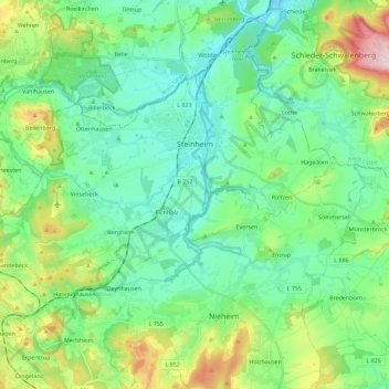
Name: Steinheim topographic map, elevation, terrain.
Location: Steinheim, Kreis Höxter, North Rhine-Westphalia, 32839, Germany (51.78411 8.94990 51.91142 9.17695)
Average elevation: 200 m
Minimum elevation: 119 m
Maximum elevation: 438 m
Thank you for supporting this site ❤️
Make a donation
Make a donation
Other topographic maps
Click on a map to view its topography, its elevation and its terrain.