
Thank you for supporting this site ❤️
Make a donation
Make a donation
Nordviertel topographic map
Click on the map to display elevation.
Thank you for supporting this site ❤️
Make a donation
Make a donation
Nordviertel
Nordviertel has 7,308 inhabitants and is therefore one of the smallest boroughs of Essen. It has an area of 2.86 km² and its average elevation is 48 metres above sea level.
Thank you for supporting this site ❤️
Make a donation
Make a donation
About this map
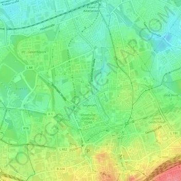
Name: Nordviertel topographic map, elevation, terrain.
Average elevation: 62 m
Minimum elevation: 33 m
Maximum elevation: 111 m
Thank you for supporting this site ❤️
Make a donation
Make a donation