
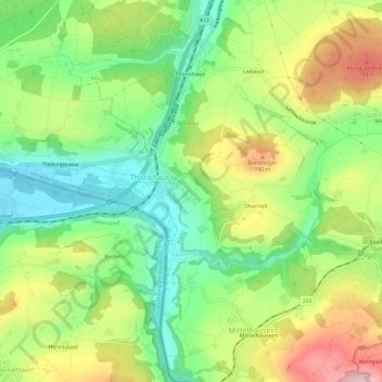
Thörishaus topographic map
Interactive map
Click on the map to display elevation.
About this map
Name: Thörishaus topographic map, elevation, terrain.
Average elevation: 653 m
Minimum elevation: 540 m
Maximum elevation: 815 m
Other topographic maps
Click on a map to view its topography, its elevation and its terrain.
Liebefeld
Schweiz > Bern > Verwaltungskreis Bern-Mittelland > Köniz
Liebefeld, Köniz, Verwaltungskreis Bern-Mittelland, Verwaltungsregion Bern-Mittelland, Bern, 3097, Schweiz
Average elevation: 593 m
Schliern
Schweiz > Bern > Verwaltungskreis Bern-Mittelland > Köniz
Schliern, Köniz, Verwaltungskreis Bern-Mittelland, Verwaltungsregion Bern-Mittelland, Bern, Schweiz
Average elevation: 683 m