
Thank you for supporting this site ❤️
Make a donation
Make a donation
Lone Star topographic map
Click on the map to display elevation.
Thank you for supporting this site ❤️
Make a donation
Make a donation
About this map
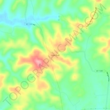
Name: Lone Star topographic map, elevation, terrain.
Location: Lone Star, Hart County, Kentucky, 42713, United States (37.38478 -85.96663 37.42478 -85.92663)
Average elevation: 228 m
Minimum elevation: 178 m
Maximum elevation: 305 m
Thank you for supporting this site ❤️
Make a donation
Make a donation
Other topographic maps
Click on a map to view its topography, its elevation and its terrain.