
Thank you for supporting this site ❤️
Make a donation
Make a donation
Ramrath topographic map
Click on the map to display elevation.
Thank you for supporting this site ❤️
Make a donation
Make a donation
Ramrath
Ramrath befindet sich auf einer Höhe von 54 NN und liegt damit etwas niedriger als die Nachbarorte. Südöstlich von Ramrath liegt Hoeningen. Westlich schließt sich Villau an die Ortschaft Ramrath an. Nordwestlich von Ramrath verläuft der Strategische Bahndamm.
Thank you for supporting this site ❤️
Make a donation
Make a donation
About this map
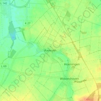
Name: Ramrath topographic map, elevation, terrain.
Average elevation: 58 m
Minimum elevation: 42 m
Maximum elevation: 77 m
Thank you for supporting this site ❤️
Make a donation
Make a donation