
Ruiru topographic map
Interactive map
Click on the map to display elevation.
About this map
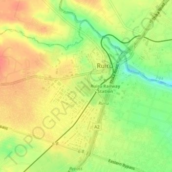
Name: Ruiru topographic map, elevation, terrain.
Location: Ruiru, Kiambu County, Kenya (-1.16498 36.93832 -1.13761 36.97252)
Average elevation: 1,531 m
Minimum elevation: 1,498 m
Maximum elevation: 1,556 m