
Make a donation
Bone Cave topographic map
Click on the map to display elevation.
Make a donation
About this map
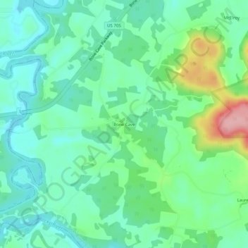
Name: Bone Cave topographic map, elevation, terrain.
Average elevation: 282 m
Minimum elevation: 242 m
Maximum elevation: 391 m
Make a donation
Other topographic maps
Click on a map to view its topography, its elevation and its terrain.
Spencer
United States > Tennessee > Van Buren County
Spencer is topographically isolated by the Cumberland Plateau's escarpment to the north and west, the Cane Creek Valley to the east, and the Dry Fork Gulf to the south. Cane Creek, along with its tributary, Dry Fork, slices a narrow valley as it spills down northward toward its confluence with the Caney Fork,…
Average elevation: 496 m