
Breda topographic map
Interactive map
Click on the map to display elevation.
About this map
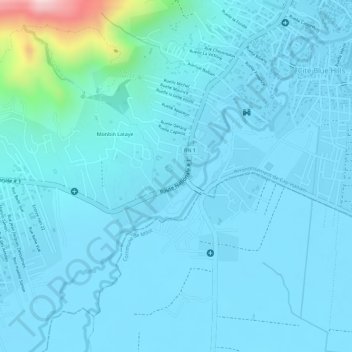
Name: Breda topographic map, elevation, terrain.
Average elevation: 38 m
Minimum elevation: 2 m
Maximum elevation: 369 m
Other topographic maps
Click on a map to view its topography, its elevation and its terrain.
nime
Haïti > Département du Nord > Cap-Haïtien
nime, Route Nationale # 1, Monbin Lataye, 1re Morne Rouge, Cap-Haïtien, Commune Plaine du Nord, Arrondissement d'Acul-du-Nord, Département du Nord, 1113, Haïti
Average elevation: 63 m