
Thank you for supporting this site ❤️
Make a donation
Make a donation
Sims topographic map
Click on the map to display elevation.
Thank you for supporting this site ❤️
Make a donation
Make a donation
About this map
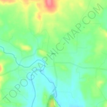
Name: Sims topographic map, elevation, terrain.
Location: Sims, Montgomery County, Arkansas, 71969, United States (34.63926 -93.71103 34.67926 -93.67103)
Average elevation: 227 m
Minimum elevation: 197 m
Maximum elevation: 285 m
Thank you for supporting this site ❤️
Make a donation
Make a donation
Other topographic maps
Click on a map to view its topography, its elevation and its terrain.