
Thank you for supporting this site ❤️
Make a donation
Make a donation
Heide topographic map
Click on the map to display elevation.
Thank you for supporting this site ❤️
Make a donation
Make a donation
About this map
Name: Heide topographic map, elevation, terrain.
Average elevation: 19 m
Minimum elevation: -1 m
Maximum elevation: 33 m
Thank you for supporting this site ❤️
Make a donation
Make a donation
Other topographic maps
Click on a map to view its topography, its elevation and its terrain.
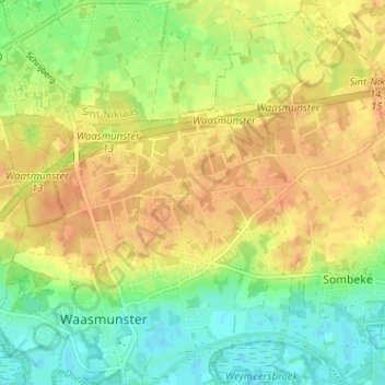
Cuesta van het Waasland te Waasmunster
België > Oost-Vlaanderen > Dendermonde > Waasmunster > Ruiter
Average elevation: 18 m
Waasmunster
België > Oost-Vlaanderen > Dendermonde > Waasmunster
Waasmunster ligt in Zandig Vlaanderen en het Waasland. De kern ligt in de vallei van de Durme en de hoogte bedraagt 4-5 meter. Op de Cuesta van het Waasland wordt een hoogte tot 30 meter bereikt.
Average elevation: 11 m