
Thank you for supporting this site ❤️
Make a donation
Make a donation
Hayden topographic map
Click on the map to display elevation.
Thank you for supporting this site ❤️
Make a donation
Make a donation
About this map
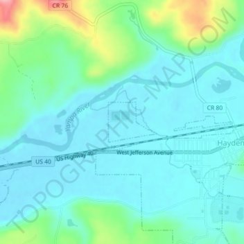
Name: Hayden topographic map, elevation, terrain.
Location: Hayden, Routt County, Colorado, United States (40.49505 -107.27672 40.49949 -107.26968)
Average elevation: 1,952 m
Minimum elevation: 1,924 m
Maximum elevation: 2,058 m
Thank you for supporting this site ❤️
Make a donation
Make a donation
Other topographic maps
Click on a map to view its topography, its elevation and its terrain.