
Thank you for supporting this site ❤️
Make a donation
Make a donation
Good Easter topographic map
Click on the map to display elevation.
Thank you for supporting this site ❤️
Make a donation
Make a donation
About this map
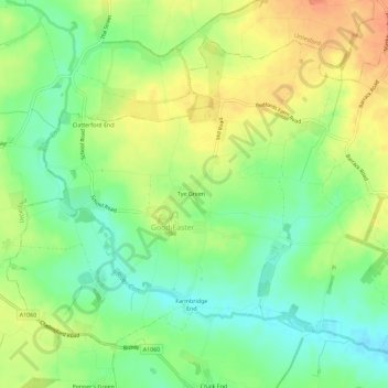
Name: Good Easter topographic map, elevation, terrain.
Location: Good Easter, Chelmsford, Essex, England, United Kingdom (51.77254 0.33216 51.80114 0.38930)
Average elevation: 64 m
Minimum elevation: 42 m
Maximum elevation: 88 m
Thank you for supporting this site ❤️
Make a donation
Make a donation
Other topographic maps
Click on a map to view its topography, its elevation and its terrain.