
Thank you for supporting this site ❤️
Make a donation
Make a donation
Keila topographic map
Click on the map to display elevation.
Thank you for supporting this site ❤️
Make a donation
Make a donation
Keila
Keila liegt südöstlich der Orlasenke auf einer Höhe von 475 m über NN in eine der schönsten naturnahen Lage im Oberland um Schleiz.
Thank you for supporting this site ❤️
Make a donation
Make a donation
About this map
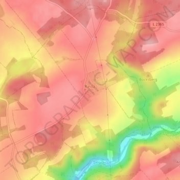
Name: Keila topographic map, elevation, terrain.
Average elevation: 446 m
Minimum elevation: 348 m
Maximum elevation: 487 m
Thank you for supporting this site ❤️
Make a donation
Make a donation