
Thank you for supporting this site ❤️
Make a donation
Make a donation
Bégouraye topographic map
Click on the map to display elevation.
Thank you for supporting this site ❤️
Make a donation
Make a donation
About this map
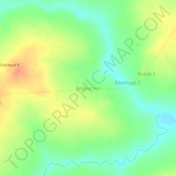
Name: Bégouraye topographic map, elevation, terrain.
Location: Bégouraye, Logone Oriental, Chad (7.90803 16.24795 7.94803 16.28795)
Average elevation: 448 m
Minimum elevation: 427 m
Maximum elevation: 472 m
Thank you for supporting this site ❤️
Make a donation
Make a donation
Other topographic maps
Click on a map to view its topography, its elevation and its terrain.