
Thank you for supporting this site ❤️
Make a donation
Make a donation
Forsyth County topographic map
Click on the map to display elevation.
Thank you for supporting this site ❤️
Make a donation
Make a donation
About this map
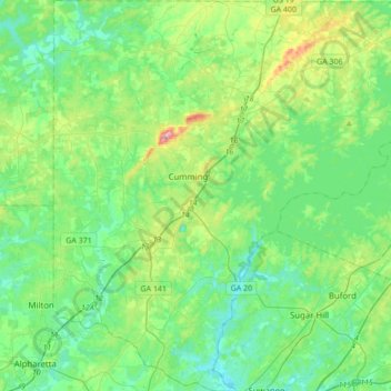
Name: Forsyth County topographic map, elevation, terrain.
Location: Forsyth County, Georgia, United States (34.05071 -84.25893 34.33517 -83.92553)
Average elevation: 344 m
Minimum elevation: 274 m
Maximum elevation: 577 m
Thank you for supporting this site ❤️
Make a donation
Make a donation