
Make a donation
Rumford topographic map
Click on the map to display elevation.
Make a donation
Rumford
According to the United States Census Bureau, the town has a total area of 69.85 square miles (180.91 km2), of which 68.55 square miles (177.54 km2) of it is land and 1.30 square miles (3.37 km2) is water. Rumford is located where the Concord, Ellis, and Swift rivers drain into the Androscoggin river. Black Mountain, elevation 2,133 feet (650 m), and Rumford Whitecap, elevation 2,197 feet (670 m), are in the north.
Make a donation
About this map
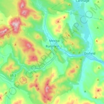
Name: Rumford topographic map, elevation, terrain.
Location: Rumford, Oxford County, Maine, 04276, United States (44.45720 -70.73271 44.61602 -70.48286)
Average elevation: 280 m
Minimum elevation: 116 m
Maximum elevation: 706 m
Make a donation
Other topographic maps
Click on a map to view its topography, its elevation and its terrain.
Sturtevant Pond
United States > Maine > Oxford County > Magalloway Plantation
Average elevation: 406 m
Mad River Falls
United States > Maine > Oxford County > Batchelders Grant Township
Average elevation: 495 m
Make a donation